Promotional banner To Be here.

The latest releases of Civil Site Design V26.10 and Stringer Topo V26.10 are here! These updates focus on addressing customer-reported issues, improving pack mode performance, and introducing new features and efficiency enhancements for working with COGO points and Survey Strings.
Civil Site Design V26.10 is available on the following platforms:
Core fixes have been added to all platforms. New features have been added to Civil 3D and AutoCAD 2025 and 2026 versions, as well as Civil Site Design. These new features will also be included in the upcoming BricsCAD V26.
Let’s have a look at the new features and improvements we’ve added to V26.10.
The latest update to Civil Site Design and Stringer Topo introduces two new default settings under Survey Defaults, designed to save time and ensure consistency across your projects.
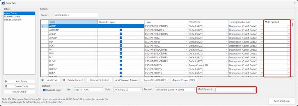
The Multi-Symbol feature has been significantly improved, providing greater flexibility and automation when working with COGO points.
Previously, multi-symbols were applied only via a point group, but now we’ve improved accessibility by integrating it directly into the Point Code Set. This means you can now create multi-symbols on your COGO points based on their Point Codes, as well as via Point Groups. This enhancement saves considerable time and ensures that your symbol representations are consistent and tied directly to your survey data.
Once created, making edits to your COGO points in the drawing will automatically reposition the scaled blocks to match.
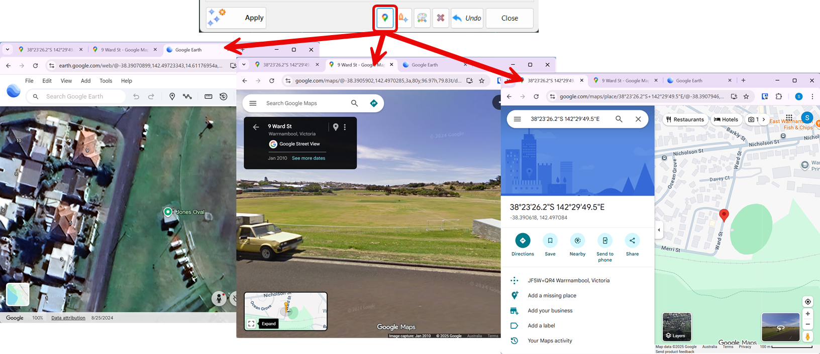
A new Launch Google button has been added to the Point Groups and Edit Point commands, providing a quick way to visualize your project data.
By selecting a COGO point and clicking this button, the software will automatically open Google Earth, Google Maps, and Google Street View to that specific point’s location. This allows for instant, real-world context and a better understanding of the site’s surroundings directly from your design environment.
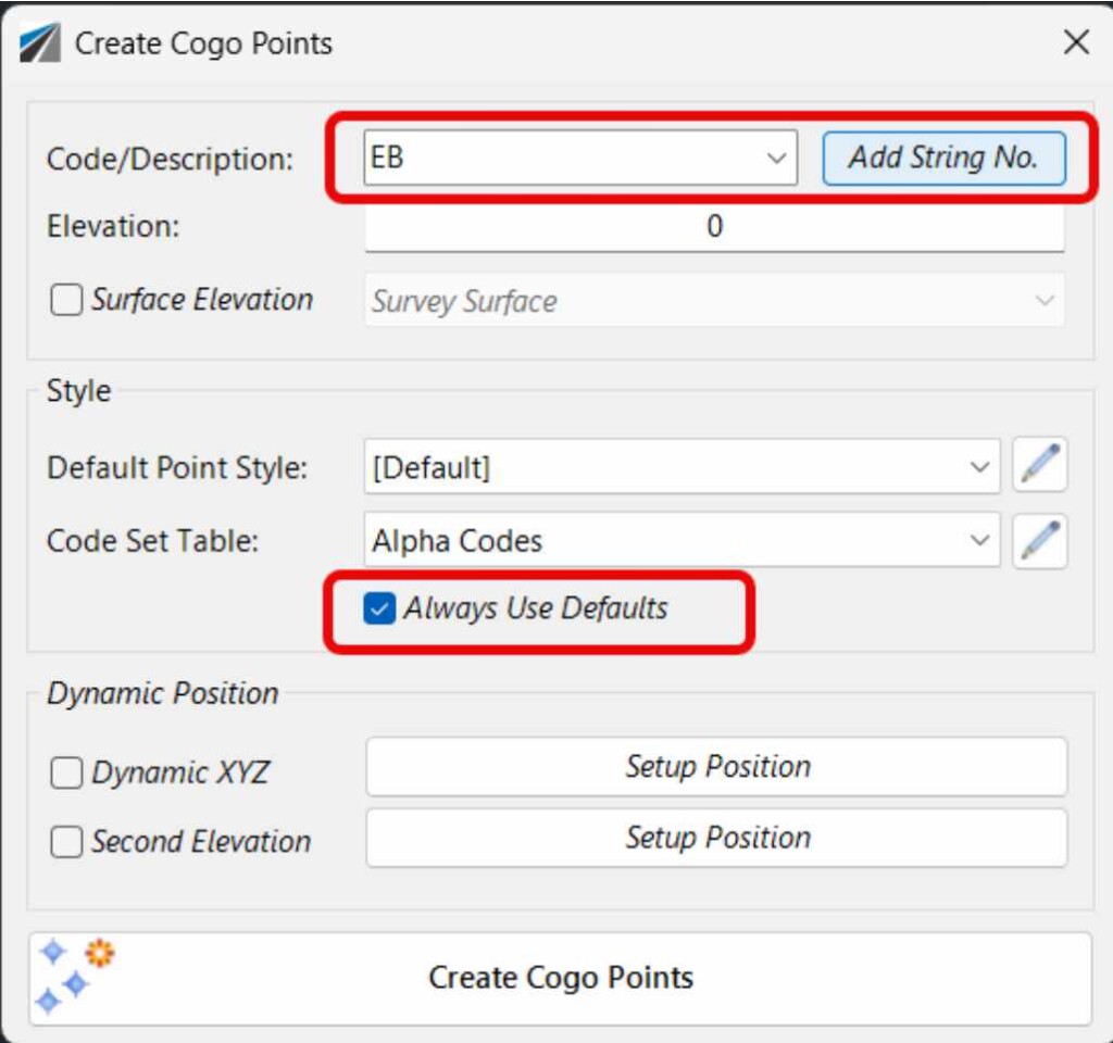
The Create Points form has been enhanced with several new features designed to streamline the point creation process.
‘Always Use Defaults’ Toggle: This new toggle gives you control over the form style defaults. You can either populate from your inputs in the Survey Defaults form or remember your last used settings.
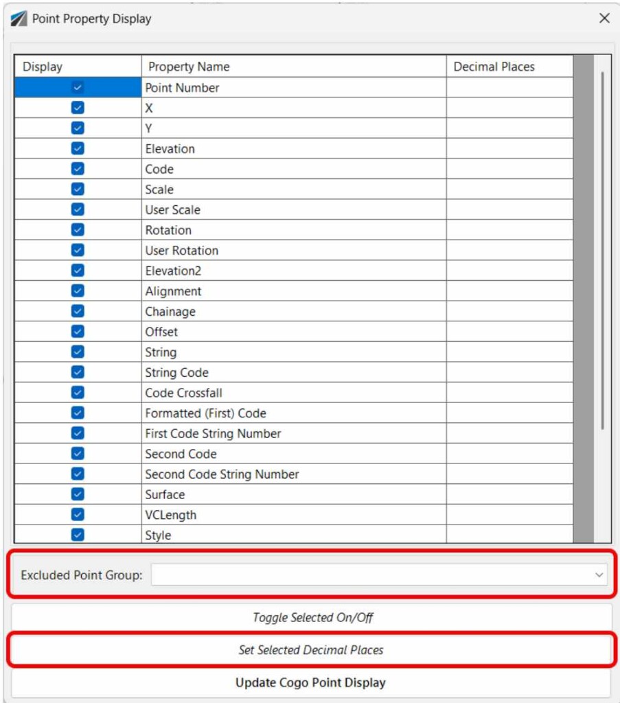
The Point Property Display form has been updated to give users more control over the appearance and editability of their points.
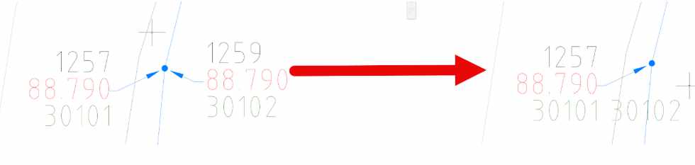
A new command, Options > Combine Duplicate Points, has been added to the Point Groups functionality. This feature is designed to clean up your data by identifying and merging duplicate points—that is, points that share the same x, y, and z coordinates within a user-defined tolerance.
When the command is run, it combines the duplicate points by appending the Code of the second point to the Code of the first point, effectively creating a “multi-coded” point. The second point is then removed from the drawing, reducing clutter and ensuring data integrity. This process helps to streamline your survey data and eliminate redundant information.
The latest updates make it easier for users to get started and for administrators to manage licenses.


Copyright Civil Survey Applications 2026 | All Rights Reserved | Website Design by Fox & Lee