Promotional banner To Be here.

Civil Site Design V26 introduces the new command Import Cogo Point File (by Alignment). This tool allows you to import a file that specifies chainage and offset along an alignment for points to be created. The command is available for Civil Site Design and Stringer across all base platforms.
This command can be found under the Cogo Points tab in the ribbon.
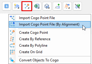
Once the command is selected, the Import Cogo Point File (by Alignment) form will appear. From here, you can select the alignment to be used, and the file containing the cogo point data.
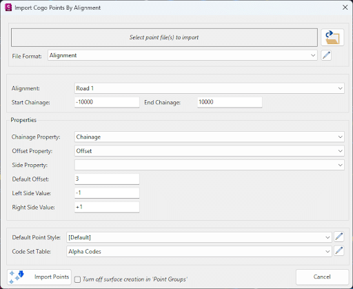
The file can be a CSV, TXT, or XML file. The file must contain the following data in order:
Once the file is selected, the data will be displayed in the form. You can then select the Create Cogo Points button to create the points.
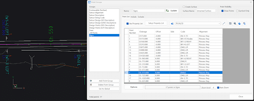
The points will be created in the drawing, and can be viewed in the Cogo Point Editor.
Watch the video below to see the command in action:


Copyright Civil Survey Applications 2026 | All Rights Reserved | Website Design by Fox & Lee